
Walk a Parkland Street Record
A Parkland street directory search works best as a sequence. Ownership is public, but occupancy is not a single county field. Start with an exact house number and street name. Save the identifiers that remain stable when names or postal forms change. Then compare independent sources dated near the time of interest. A homestead exemption may support an owner-occupancy inference, yet it never names every person in the household.
- Search the Broward County Property Appraiser by address. Save the folio, owner, situs address and legal description.
- Open the parcel map and inspect nearby lots. Confirm that the parcel lies inside Parkland rather than relying on its mailing city.
- Use the owner and folio in Broward Official Records. Match deeds by legal description, not surname alone.
- Add Parkland permits and lien results for address-specific city facts. These can name an applicant, owner or contractor without proving residence.
- Use election records or verified directory editions only for the date and access channel they actually cover.
The chain is address to parcel, parcel to owner, and folio to deed. It does not become a resident roster. When the question is historical, the Parkland city directory collections explain which Broward editions might add a name, phone number or old address.
Search Parkland Parcels by Address
BCPA is the strongest first stop for a modern Parkland street directory search. Its property card joins the physical, or situs, address to the owner of record, mailing address, folio, legal description, values, exemption flags and deed references. The mailing address is where tax notices go. It can be elsewhere, so it should not be treated as proof that an owner lives on the parcel.
| BCPA control | Input | Required | Parkland use |
|---|---|---|---|
| Parcel ID | Text | Yes in tab | Exact folio lookup |
| Name | Text | Yes in tab | Owner-of-record search |
| House Number | Text | Yes for address | Numeric street component |
| Street Name | Text | Yes for address | Omit direction and road type |
| Collect Parcels | Map tool | No | Select several adjacent lots |
| Area, Distance, Location | Map tools | No | Measure land, not residents |
Try the base street name without Street, Avenue or Boulevard, then choose the right candidate. Copy the folio exactly. The official sources do not publish a safe digit-by-digit decoding rule, so guessing at its parts can point to the wrong lot.
Map Parkland Streets and Lots
The BCPA parcel map turns one search result into a street segment. Select the parcel, pan along the road, and use Collect Parcels for nearby lots. Useful layers include house numbers, streets, parcels, subdivisions, city limits, ZIPs, zoning, land use, census tracts and flood areas. The map can show rear neighbors that a simple address list may miss.
The captured BCPA map interface below shows the official tool used for parcel inspection.
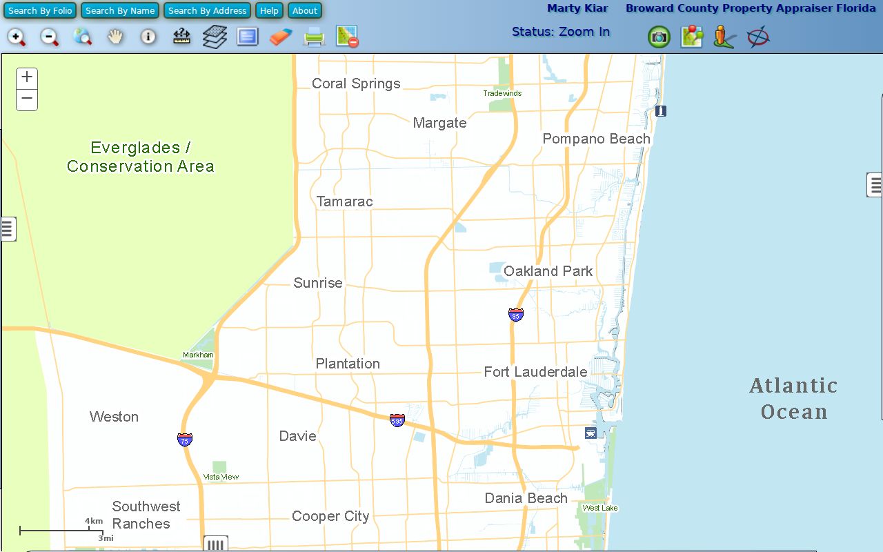
Its layers help distinguish a postal Parkland address from land within the incorporated city. They also expose subdivision and lot geometry that can be carried into deeds, plats and permits.
BCPA shows owners, not whole households. Its map has measurement controls, but no verified resident-radius search. A Parkland street directory should therefore describe each returned name as an owner of record unless another dated source supports a different label.
Parkland Records Keyed by Street
Several custodians contribute to an address trail. No one portal contains all of it. The current parcel roll provides the spine, while deeds, plats and city files add distinct facts. Election tools require special care because the public individual lookup verifies one known voter and the Precinct Finder returns electoral geography, not a list of people on a block.
| Address source | Official keeper | Evidence returned | Access route |
|---|---|---|---|
| Parcel roll | BCPA | Owner, situs, mailing address, folio, legal description and sales | Free web search; request unavailable old rolls |
| Parcel GIS | BCPA and Broward | Lot geometry, subdivision, city, ZIP and adjoining parcels | Free map viewer |
| Deeds, liens and plats | Broward Records, Taxes and Treasury | Recorded parties, transfers, releases and lot framework | Online index plus Search & Copy for older film |
| Permits and plans | Parkland Building Division | Applicant, owner, contractor, scope and dates | Forms page, office or retrieval request |
| City lien result | Parkland Finance | Code liens, assessments, open permits and fees | Written request by address |
| Precinct geography | Broward Supervisor of Elections | Precinct, polling and district context | Free address lookup |
A folio and legal description connect most of these systems. Street spelling alone is less durable, especially for land recorded before the city existed or lots whose postal and municipal labels differ.
Follow Parkland Deeds by Folio
Broward Official Records separates recorded land instruments from court files. Search modes include Name, Book/Page, Document Type, Instrument Number, Case Number, Consideration Amount, Date Recorded, Simple Search and Parcel ID. A result may show the instrument, record time, document type, grantor and grantee roles, book and page, parcel or legal description, consideration and related instruments. A grantor transfers an interest; a grantee receives it.
Online coverage has a precise boundary. The portal is limited from March 9, 1972 through July 7, 1977, and full searching begins July 7, 1977. Plats and maps are indexed regardless of date. Earlier deeds require Search & Copy or film, available through 954-831-4000. Search fees are published as $2 per name per year, ordinary copies as $1 per page, and certification as $2 per instrument.
Match the land. Search an owner's exact surname, initials, spouse, trust and entity forms, but accept a deed only after its folio or legal description matches.
Parkland Street Record Terms
Four terms prevent common mistakes in a street-by-street search. They describe different parts of the record chain, and none means that every person at an address has been identified.
- Parcel or folio
- The county identifier for a mapped property. It is the best bridge between the appraiser, map and recorded instruments.
- Situs address
- The physical address assigned to the parcel, which can differ from the owner's tax mailing address.
- Plat
- A recorded map that lays out a subdivision, lots, blocks, streets and related dedications.
- Criss-cross directory
- A directory arranged by address or street instead of surname. Parkland coverage must be confirmed with library staff before relying on it.
These keys matter because a deed may omit a modern house number. A lot and block description can keep the chain intact after a road label, subdivision name or city boundary changes.
Add Parkland Permits and Liens
Parkland City Hall adds records created by municipal work. The Building Division forms page includes permit forms, owner-builder material, certificates and a Records Retrieval Request. That form asks for street address, lot and block or unit, subdivision and certificate-of-occupancy date. It offers view-only, copied-plan and original-record choices. The stated retrieval fee is $25, and pulled files remain at the office for 30 days.
A separate city lien request costs $60 per address and states a three-to-five-business-day response time, excluding mail. It asks for the owner, owner address, legal description, tax folio and other transaction facts, then reports code-enforcement liens, assessments, recording fees and permits. Incomplete forms are returned, and the response is mailed using a self-addressed stamped envelope.
Parkland moved building services from its old system to MyGovernmentOnline, and permit fees changed in October 2025. The portal shift makes the forms page and a focused public-record request important fallbacks when an older file is not found online.
Parkland Streets Cross Boundaries
A mailing line is not a legal border. ZIP codes 33067 and 33076 both include Northwest County parcels, and 33076 reaches Coral Springs and unincorporated pockets. A property labeled Parkland by mail can sit outside the city. Confirm municipality through BCPA's city or millage fields and the GIS City Limits layer.
The record vocabulary also changes with time. Parkland began with about 420 acres in 1963, expanded to more than 8,000 acres in the 1970s, and did not get paved roads until the 1980s. Early evidence may use unincorporated Broward, a subdivision, or township-range-section instead of Parkland. Pre-1915 land may lie in Dade or Palm Beach predecessor custody because Broward County did not yet exist.
Note: Treat ZIP, postal city, parcel municipality and legal description as separate fields until the official map confirms that they describe the same land.
Voter Records Are Not Street Lists
Florida's voter-status tool requires first name, last name and date of birth. It verifies one identity and cannot browse all names on a Parkland road. Broward's Precinct Finder accepts an address but returns district and precinct context, not resident names.
A broader state voter extract is available by request, not as an instant download. The requester supplies contact information and a mailing address through VoterFileRequest@dos.myflorida.com, then receives physical media by mail or pickup in Tallahassee. Protected identifiers, signatures and Address Confidentiality Program records remain restricted. A participation marker shows that an election was recorded, never the person's ballot choices.
For the Parkland street directory, voter data is supporting evidence dated to its record cycle. Inactive status, list maintenance and moves mean an old registration cannot prove who occupies a property now.
Older Parkland Streets Need Libraries
Broward Main Library's fifth-floor directory database searches names, telephone numbers and addresses. The Fort Lauderdale Suburban run covers 1975 through 1986 and may include Parkland, but the published guide does not confirm its exact geography. Ask staff before calling it a Parkland criss-cross source. Older telephone directories are held in Periodicals on microfiche, with staff retrieval and microform help.
After 1986, use BCPA, deeds and permits. For earlier dates, compare verified directory editions with public federal census schedules through 1950 and newspaper images. No Parkland Sanborn sheet was found. Fort Lauderdale sheets document the regional urban core, not houses in Parkland, so they should not be used to fill that gap.
Note: Main Library reference staff can confirm a directory edition's geography before a name or address result is attributed to Parkland.
Limits of a Parkland Street Directory
Public address records do not identify every non-owner occupant, child, partner or guest. Utility customer lists and driver records are not public resident directories. A trust or company may hold title, and an owner mailing address may point away from the property. Protected voter addresses are suppressed. Even a homestead flag supports only an inference that an owner claimed the parcel as a primary residence for tax purposes.
Use exact labels: owner of record, tax mailing address, named deed party, permit applicant or registered voter. A deed proves a recorded transfer, not physical occupancy. A parcel card proves assessment facts, not a household. That care is what makes a Parkland street directory useful for family research, estate work, property history and civic curiosity.
Lawful use. Parkland address records are for personal, lawful research. Never use them to stalk, harass, threaten or expose a protected person.